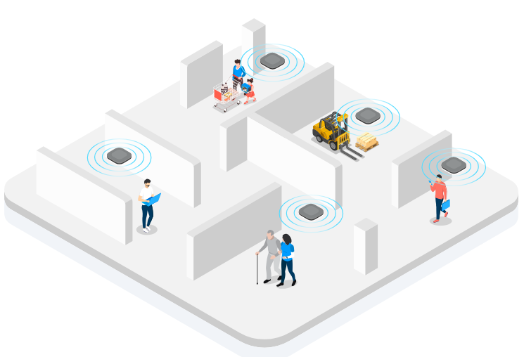
In the wave of digital transformation, real-time location systems (RTLS) have become the core infrastructure for optimizing resource scheduling and improving security in industrial manufacturing, medical health, logistics warehousing and other fields. By converting the location of objects in physical space into analyzable digital coordinates, RTLS provides key data support for intelligent decision-making.

Core component architecture of RTLS
The RTLS system is composed of a hardware perception layer, a network transmission layer and a software analysis layer. Each module realizes a closed-loop data flow through a standardized interface.
Location Tags
Location tags are terminal devices attached to tracked objects (personnel, equipment, assets, etc.). Their core function is to send identity and status data to the positioning base station through wireless signals (such as UWB, Bluetooth, Wi-Fi, RFID, etc.). Tag design needs to take into account both power consumption and performance: low-power tags (such as Bluetooth AoA tags) can support several years of battery life and are suitable for long-term deployment scenarios; high-precision tags (such as UWB tags) achieve centimeter-level positioning through nanosecond timestamps to meet precision manufacturing needs. Tags usually integrate modules such as accelerometers and temperature sensors, which can simultaneously report motion status and environmental parameters.
Positioning base stations (Anchors/Readers)
The base station is the "spatial coordinate anchor point" of the system. It receives tag signals and calculates arrival time (TOA), arrival time difference (TDOA), arrival angle (AOA) or signal strength (RSSI), and determines the tag location in combination with triangulation or multi-lateral positioning algorithms. The performance of the base station directly affects the system capacity and accuracy: base stations that support multi-band communication are compatible with different tag types; base stations with beamforming technology can improve the signal anti-interference ability. Base station deployment needs to cover the target area and avoid signal blind spots. Its density and layout need to be dynamically adjusted according to scenario requirements.
Network communication module
The network module is responsible for data transmission between the base station and the cloud platform, and must meet the requirements of low latency and high reliability. Wired networks (such as Ethernet) are suitable for fixed base station deployment and provide stable transmission channels; wireless networks (such as LoRaWAN, 5G) support mobile base stations or wide-area coverage scenarios. LoRaWAN is suitable for remote areas with its low power consumption characteristics, and 5G supports video streaming and real-time control data transmission with high bandwidth. The network protocol needs to consider data priority and security mechanisms to ensure that positioning data is transmitted first and is not tampered with.
Positioning engine and cloud platform
The positioning engine is the "computing brain" of the system. It outputs the real-time coordinates and movement trajectory of the tag by integrating multi-base station data and algorithm models (such as Kalman filter and particle filter). The cloud platform integrates functional modules such as map engine, path planning, and anomaly detection to convert the original positioning data into a visual interface and decision-making basis. The platform needs to support open API interfaces to facilitate integration with enterprise ERP, MES and other systems to achieve business closed loops such as asset scheduling and safety warning.
Key settings for RTLS system deployment
Requirement analysis and scenario adaptation
Before deployment, the core goals of the system need to be clarified: if personnel safety monitoring is required, tags that support regional fences and emergency call functions need to be selected; if equipment utilization needs to be optimized, tags need to have status monitoring and predictive maintenance capabilities. Scenario characteristics (such as building structure, obstacle distribution, and electromagnetic environment) directly affect technology selection: UWB technology with strong anti-interference ability needs to be used in metal-dense environments; Bluetooth or RFID solutions with lower costs can be selected in open areas.
Base station layout and signal calibration
The layout of base stations must follow the principle of "no blind spots in coverage and no signal overlap". Generate heat maps through signal simulation tools to optimize the base station location to eliminate the occlusion effect. The calibration process includes:
Coordinate calibration: Select at least 3 known coordinate points in the site, measure their actual distance from the base station and enter them into the system;
Parameter configuration: Set the base station communication frequency band, power level and synchronization mode to ensure that the time synchronization error of multiple base stations is less than 1 microsecond;
Error correction: Adjust the positioning model parameters through iterative algorithms to control the deviation between the system output coordinates and the actual position within the allowable range.
Tag configuration and data binding
Tag initialization requires setting a unique ID, communication protocol and reporting frequency. The reporting frequency needs to balance real-time performance and power consumption: static assets can be configured to report once a minute, while mobile devices need to report every second to capture movement trajectories. The binding of tags and objects must be achieved through NFC, QR code or manual input to ensure the accuracy of data association. In addition, the sleep mode and wake-up conditions of tags need to be configured to extend battery life.
Network optimization and security reinforcement
Network optimization includes:
Bandwidth allocation: set QoS priority for positioning data to ensure that key information is transmitted first;
Channel planning: select the channel with the least interference in Wi-Fi or Bluetooth environment to improve transmission stability;
Edge computing: deploy a lightweight positioning engine locally to reduce cloud computing latency.
Security reinforcement needs to cover data transmission (using AES-256 encryption), device authentication (based on X.509 certificates) and access control (RBAC permission model) to prevent positioning data leakage or illegal tampering.
From centimeter-level positioning to intelligent decision-making, the technical boundaries of RTLS are constantly expanding. Its modular architecture and open ecology enable the system to quickly adapt to the needs of different industries and provide accurate spatial data support for scenarios such as Industry 4.0 and smart cities.